Circumnavigating the world through Human Power while connecting different societies, civilizations and landscapes.

Showing posts with label route. Show all posts

Friday, July 17, 2015

Future Sections


As of July 25th, 2015, the best guestimate for the total amount of mileage to be covered is 65,500 kms / 44,700 miles.

Dimitri has covered so far 17, 814 kilometers (11, 069 miles) from Anchorage, Alaska, USA to Bukhara, Uzbekistan, which means that approximately 27% of the kilometers have been already completed by foot and cycle.

47,703 kilometers to go...

Click here to read more on the history of the expedition.

Now,  here is what's next:

Thirteenth section from Bukhara, Uzbekistan to Aswan, Egypt


Distance: Cycling 6530 kms (1718 miles) from Bukhara, Uzbekistan until Aswan, Egypt.

Time frame: Starting August 14th 2015 in Bukhara, Uzbekistan.

Click here to read more information about this Bukhara - Uzbekistan section.

Note:  If we are not able to obtain the permission to be able to cycle across Saudi Arabia,  we will then proceed with our alternate route through Iran which instead of taking us southbound towards the strait of Hormuz, will take us straight west towards Turkey, southern Europe, etc...
At that point, we will revise our route and maps, and shared it on this site


Fourteenth section: From Aswan, Egypt to  Cape Town
Distance: Cycling 9524 kms
Time frame: TBD


Fifteenth section: Cape  Town to Florianópolis, Brazil

Distance: Rowing 7000 kms
Time frame: 4 months


Sixteenth section: Florianópolis to Tres Cerros, Argentina (2d Antipode)
Distance: Cycling 3736 kms
Time frame: TBD


Seventeenth section: Tres Cerros to Seattle, Washington USA
Distance: Cycling 15249 kms
Time frame: TBD


Eighteenth section: Seattle  to Knik Lake, Alaska (The starting and ending point of this circumnavigation.)

Distance: Kayaking 3641 kms
Time frame: TBD


We will have completed the entire expedition, upon reaching Knik Lake, after having circumnavigated the globe, crossed the equator and reached two antipodes via human power.


Update on antipodes
July 30th 2015


While further studying our Nexus Expedition route (completed and future sections), and the antipode map, we have been able to define a new set of antipodes, which will be easier to reach, 600 kms closer.

This is once again, in order  to comply with the current definition of a  Human Powered True Circumnavigation.

Indeed, the new antipode is going to be near the town of Tres Cerros, Argentina.
It is located on the eastern coast of the southern hemisphere, 600 kms, east of the previous antipode which was located in  Caleta Yungay, Chile, on the western coast of the southern hemisphere.


New antipode: Tres Cerros, Argentina


As a result, the two new antipodes are:

1st antipode
: N 47° 49' 8.7278"     E 112° 31' 46.2158"
Location: On the trail between Choibalsan and Bayan Ovoo,  Mongolia, which I crossed in October 2014.

2d  antipode:  S 47° 49' 8.7278"     W 67° 28' 13.7842"
Location:  North of Tres Cerros, Argentina, which we plan to reach in the next few years.


New Antipodes: Bayan Ovoo (Mongolia), Tres Cerros (Argentina)


Antipode Map
 
 
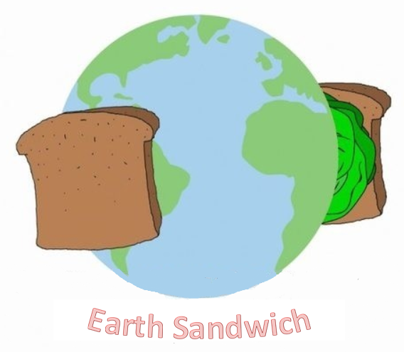
So, here we are.... Going for a human-powered Mongolian-Argentinian "Earth Sandwich"!


Thursday, May 26, 2011

Planning the first 1760kms bicycle section: Omsukchan-Yakutsk


Omsukchan - Yakutsk 1760 kms - Summer 2011 Planned Route


Yes, indeed, after having spent the last few winters pulling a sled, it's time for me to get reacquainted with the bicycling world!

In less than 11 weeks, in early August 2011, I am due to start bicycling westward out of Omsukchan (where I last stopped with my sled in late April 2011) towards Yakutsk and proceed furthermore southwest, towards Mongolia.

I am also excited to announce that my girlfriend Gulnara Miftakhova is planning to join me bicycling for this next section of the expedition!


Note: By the way, going forward, I will try to use the term "bicycling" exclusively and refrain myself from using the term "biking" which has apparently confused some of my international readers, wondering if we were planning to travel by bicycle or motorbike!

So, between Omsukchan, Magadanskaya Oblast and Yakutsk in the Republic of Sakha, we are planning to bicycle the following route:


Additional Notes:

July 1st 2011-: have also been forwarded the Russian following link that highlights the Road of Bones route taken by Russian cyclists: КОЛЫМА - 2008
well as a video taken by Milosz Augustyniak, a pole hitchhiker in June 2011.

July 12th 2011:
Between July 8th and August 10th, 8 bicyclists are riding from Yakutsk to Magadan. We hope to meet with them while traveling in opposite direction.

July 26th 2011 : Australian hitchhiker 2010 report on the Kolyma highway.


Part 1. The first 251 kms from Omsukchan to the intersection with the Kolyma Highway, aka "Road of Bones". This promises to be a busy dusty and potentially dangerous narrow road where we will be passed by countless supply trucks coming in/out of Omsukchan and Ducat silver and gold ore mines.

Part 2. We will then travel the next 404 kms on the wider Kolyma highway until we reach Kadykchan, this time side by side with a greater amount of large Kamaz and Ural trucks travelling at high speed between Magadan and Susuman.

Part 3. In Kadykchan, we will definitely be glad to leave the trucks and the "dirt highway" behind and get on the more bucolic/rustic "old road" for the next 405 kms, via Tomtor all the way to Kyubyume in the Republic of Sakha (Yakutia).


I am actually really looking forward to this more peaceful section away from the large trucks commuting between Magadan and the gold mining communities in Northern Magadanskaya Oblast.

September
2011 Update: For anyone who wonders, yes, we did decide to go with the “new” road and forgo the “old” road between Kadykchan and Kyubyume, (even if it meant an additional 110 kms of cycling for our route), because we received reports from travelers who tried and failed to take the old route in landcruisers/kamaz and motorcycles from both sides (Kadykchan and Kyubyume) and told us that at this time (early September) the rivers were way too high and too furious to cross/ford safely on bikes and/or by foot.


Old rustic 405kms bypass


Note on River crossings: In April 2011 while in Magadan, I was able to meet several bicyclists and truckers who are familiar with the Omsukchan-Yakutsk route and I now know the following:
a. In August, the rivers tend to be much smaller than in early summer and therefore can be crossed easily.
b. In the case of a downpour, we may need to wait 1-2 days for a river to recede before we can cross it.
c. For the larger rivers we will have to find an alternative solution such as using inflatable kayaks or something similar to cross the river and ensure the continuation of this "human-powered" expedition.


Part 4. In Kyubume, we will get back on the main Kolyma "dirt highway" and travel 320 kms further to Khandyga.

Part 5. In Khandyga, we will travel 380kms further to reach Yakutsk.

Total: Omsukchan-Yakutsk - 1760kms / 1094 miles


After Yakutsk, our goal is to travel on our bicycles southwest towards Mongolia and continue further through Kazakhstan, and through some of the Central Asian states (Kyrgystan, Tajikistan, Uzbekistan, Turkmenistan), some of the Middle Eastern countries (Iran, Turkey, Syria, Jordan, Israel), and some of the Northern African countries (Egypt, Libya, Algeria, Mauritania, Senegal) where it will be time to row!
Of course, the exact route will be determined as we progress, partly depending on geopolitical conditions.


In the last few years, I partook in a few biking races such as crossing South Africa from Durban to Capetown in the Freedom Challenge (2005) and competing in the challenging La Ruta de Los Conquistadores in Costa Rica but never really undertook a loooong bicycling expedition of this caliber: Going from Omsukchan (Far Eastern Russia) to Dakar (Senegal, West Africa).


Bicycling 2200kms across South Africa, Freedom Challenge, Feb 2005


So, yes, at this stage, we are definitely learning as quickly as we can, about "adventure cycle-touring" logistics.

We are currently researching what are going to be the best bikes for us to use, the best waterproof clothing, paniers, spare gear, etc...

To that effect, I have been gathering valuable information from my friends at Angus Adventures, Asiemut, Panamerika, World's End Trek and amongst other sources, from the "Adventure Cycle-Touring Handbook".


But, PLEASE, feel free to email me directly at dimitri_kieffer@hotmail.com if you want to share any tips and recommendation you might have on bicycles and bicycle gear, "bullet-proof" waterproof clothing, etc... And yes, we are definitely looking for new reliable sponsors in the bicycling arena.
So, once again, please feel free to send me the recommendations you might have so that we can use and promote their reliable brand along the way!


Finally, over the next few weeks, I am still planning to post some of my favorite pictures/videos and stories on what I have experienced this spring while pulling my sled from Paren to Omsukchan.
Stay tuned!

Thursday, January 20, 2011

Details on Winter 2011 Route (Paren - Omsukchan)

Total of kilometers estimated: 680 kms / 422 miles
Planned max amount of days on trail: 70


1st section: Paren (Kamchatka Koriak Okrug) toVerniy Paren (Magadanskaya Oblast)

50 kms estimated. Max 5 days
Going northwest, following potentially (and hopefully!) a small snowmobile trail, going through the Paren river bed, and along the flanks of the hills located on the eastern side of the river.
Moving between the two remote Koryak fishing & hunting villages, of Paren (Парень) & Verniy Paren which have a current local population of about 60 souls each.
On a sidenote, the village of Paren was well-known in the past throughout Russia for its infamous knives which were built massively with the shipwrecked metal collected on the shore!

Along the way, I will be crossing the "border" between the two states, leaving Kamchatka behind and entering for the first time my 3rd Russian state by foot: Magadanskaya Oblast!
(More information on Magadan Region)

2d section: Verniy Paren to Ghiziga (Magadanskaya Oblast)
200 kms estimated. Max 20 days
This is probably going to be the hardest and most remote section this winter. I plan to trek between Verniy Paren and Ghiziga, hopefully following the wezdehod route where a single wezdehod (вездеход) makes the monthly round trip from Ghiziga to Verniy Paren in order to resupply Verniy Paren with food products.

Needless to say that as soon as the first blistering storm/purga (пурга) would have passed through, I will probably not be able to find any more wezdehod tracks to follow and will simply have to rely on my map, GPS and common sense to be able to move forward towards Ghiziga.
Nothing new!

However, I have heard that 10 kms northwest of Verniy Paren, I might come across a Koryak reindeer brigade where I will be glad to stop and meet/stay with the nomadic herders if I come across them, as I have had the chance to experience twice last year in Chukotka and Kamchatka!


After that, I am planning to continue following the Paren, Chernaya and finally Ghiziga river systems towards Ghiziga (Гижига).

3rd section: Ghiziga to Evensk (Magadanskaya Oblast)
80 kms estimated, Max 8 days
Planning to follow the winter/zimnik road (зимник) between Ghiziga and Evensk.

4th section: Evensk to Tavatum (Magadanskaya Oblast)
100 kms, Max 10 days
In Evensk (Эвенск), planning to resupply with food & stove fuel.
Then, follow the coast on hopefully an existing winter/zimnik road towards Tavatum.

I have seen pictures of the Tavatum hot springs, Таватумские горячие источники in a book and definitely hope I will be able to stop there for some well deserved rest!

Alternate route: In Evensk, I will gather more information from the local authorities on whether the route through Tavatum to Omsukchan is the most suitable or whether I should consider going on the zimnik route leading to the gold mine of Kubaka (кувака) via Tenkeli & Buksunda.

5th section: Tavatum to Viliga -Kushka (Magadanskaya Oblast)
70 kms estimated, Max 7 days
After Tavatum, I plan to continue along the coastline, following hopefully an existing zimnik/winter road.

6th section: Viliga-Kushka to Merenga (Magadanskaya Oblast)
80 kms, Max 8 days
After Viliga-Kushka, I plan to follow the Viliga river upstream towards Merenga on hopefully an existing zimnik/winter road.

7th section: Merenga to Omsukchan (Magadanskaya Oblast)
100 kms, Max 10 days
After Merenga, I plan to continue upstream towards Omsukchan on hopefully an existing zimnik/winter road.

I plan to stop in Omsukchan (Омсукчан) (More info at Мой Омсукчан) once I reach the infamous M56 Kolyma Highway also known as "road of bones" which connects Magadan to Yakutsk and plan to return this summer to continue my circumnavigation of the globe. This time I will be biking for a change instead of skiing & pulling a sled!
Landing in Omsukchan will mark my completion of what I called the "Missing Link".

In deed, the roadless section from Anchorage, Alaska to Omsukchan, Russia represents a "missing link" in the chain of asphalt, gravel and dirt roads which connect our continents going from Tierra del Fuego at the southern tip of the Americas to Capetown at the bottom of South Africa!
My Missing Link!
5310 kilometers / 3300 miles

Thursday, October 14, 2010

Shooting for February 2011!

On track to resume the expedition in February 2011 in the Koryak village of Парень (Paren), in the Northwestern corner of the Koryak Okrug, which is itself in the Northwestern corner of the Kamchatkan region, in Far-Eastern Russia.

I plan to return to Paren via:
- Moscow-Magadan-Evensk by plane
and then proceed
- Evensk-Verhny Paren-Paren by vezdehod and/or snowmobile.


I will then start in Парень (Paren), where I last left off in June 2010, and proceed towards Omsukchan by foot, using skis and snowshoes while pulling a 150-200 lbs sled.


I plan to complete this coming spring 2011, the 700 kms section which separates Paren from Omsukchan.

Once in Omsukchan, I will be able to join the M56 Kolyma Highway also known as the infamous "road of bones" .

At that point, I will have completed and therefore connected by human power, what I like to call the "missing link" between Omsukchan, Russia and Anchorage, Alaska,USA.

This"missing link" is indeed where no connecting paved roads exist between the European & Asian continents and the American continents.